
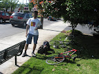
Biking to Kapowsin, WA
My friend who is also an avid amateur biker like me made a trip to seattle for a couple of days with some others. We decided to rent a bike for him and go some place. We thought about Snoqualmie falls, located east of seattle, further ahead of Issaquah. But apparently, his group was headed there. Hence, we thought of biking to the base of Mount Rainier, whatever that meant.
Kapowsin, which is a rural hamlet, located around 95 kms from Seattle downtown seemed to be the closest point from Tacoma to Mount Rainier national park and hence we decided to head there.

Since we had little time to plan, we didn't go into other alternative options that might have made better sense. The idea was to do some good biking on some of the steep roads in the country, get to the destination, possibly get a good view of Mount Rainier and be back before the end of the day. Since a 180 kms round trip seemed impractical, we decided to make it a 90km roundtrip by taking the bus till half-way, i.e. Tacoma.
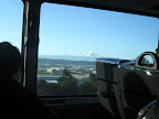
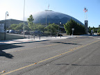
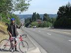
We started out at 5 am and reached Tacoma dome by 6:30 am.
Since there were very few food stores open, we had to go around till we found a place to buy lunch. We started biking at 8 am and immediately noticed the elevation gain.
After the initial elevation gain, the roads were more or less flat all the way.

We took regular breaks every 20 minutes.
The mistake we did on this trip was not to carry a full blown map. We just had directions from Tacoma to Kapowsin.
What we didn't anticipate was that our curiosity in exploring new places or roads might get us lost or frustrated.
We had to abandon our initial route since the road we had chosen was unpaved. Luckily for us, mount rainier was the guiding sage. I mean, we were headed over there and when it towers 14,000ft asl, its hard to go in the wrong direction.

When we left a town called Pullyap where it seemed like everything (schools, sports fields, shops, houses) was put in just the right place (model town), we were in for a shock. We had to do non-stop climbing for 10 minutes so as to gain an elevation of 400 ft. That left us beat.
Luckily, it was all downhill or flat from there on till Graham, a town before Kapowsin.

A vintage train by the road
From Graham to Kapowsin, we got some of the best views of Mt. Rainier on the route. Its difficult to describe how it feels to see such a huge mountain upclose (from 25 miles away!) and without cloud cover.. simply elevating.

We were really tired when we reached Kapowsin after 5hrs of biking and we took a break for around 2 hrs. I caught up on some food, fluids and sleep.

Lake Kapowsin

Boating are there

Beyond: Electron reservoir and village
We couldn't do much sightseeing around Kapowsin because we were too tired from biking and lack of sleep.
Instead, we decided to take another possible route back to Tacoma and that turned out to be good decision.

Map showing the onward and return routes
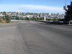
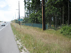
Peaceful country roads
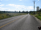
We took the Orting-Kapowsin road all the way to Ortin, a hamlet south-east of Pullyap. The scenery on the way to Ortin was pretty beautiful.

The landscape was an eye-candy even after we passed Ortin with yellow-green grass in the foreground and the dark green pines in the background.

We did some fast biking on this stretch till we reached Tacoma, but we did get lost on the way and were asking too many people for directions. The return journey was faster (4.5 hrs) despite being a longer route.
Overall it was a "decent" experience. Kapowsin is a cool place by the lake but it doesn't have any known trails that take you to Mount Rainier base camp. The most well-known trails (hiking, biking, etc) that approach Mount Rainier national park are ones from the north( carbon river road trail and mowich lake trail) and one from the south (paradise road trail).
However by car, there is the SR 410 that goes upto 8000 ft high.
Quick directions: From Tacoma, take the Portland avenue all the way till it joins Meridian Avenue and 112st. Head down as you pass by Graham till you come across the Kapowsin Hyw rd which takes you to Kapowsin. (We ofcourse didn't follow this route for many reasons).
 Route on google map
We had some good and bad experiences on the trip which made us think on what's important for a biking trip -
A "biking road trip" has many components, a few important ones are:
a) The place you are headed. You can have high expectations of the place provided you get to know of the place from some one... Not otherwise. Researching the place and its surroundings will help a lot, especially if the place is not a popular destination.
b) If the idea of the trip is to not just bike but also explore the destination or the route taken, the biker needs to make sure that he is fit enough for the ride. Training frequently helps.
c) Maps. Very important especially if you are going to explore places or roads. Maps also ensure that you don't get 'lost'!!
d) Food and water: We didn't have any problem here since we had enough food and water was available at '7-11' stops on the way. But some rural roads might not have stores and hence in those cases its good to take more water for the trip.
e) Guiding device: GPS, compass, etc. This will work when maps don't or when you don't have maps of some particular region you want to explore. Some examples are forest cover with dense bushes, hills with no clear trails, places with little information on the web.
f) Riding safety: When riding on shoulders on main roads such as arterial highways, take note of the traffic on the road. If the traffic seems congested or is too fast it is better to slow down and move to the sidewalk or focus more on riding parallel to the shoulder line.

Since we had little time to plan, we didn't go into other alternative options that might have made better sense. The idea was to do some good biking on some of the steep roads in the country, get to the destination, possibly get a good view of Mount Rainier and be back before the end of the day. Since a 180 kms round trip seemed impractical, we decided to make it a 90km roundtrip by taking the bus till half-way, i.e. Tacoma.
We started out at 5 am and reached Tacoma dome by 6:30 am.
Since there were very few food stores open, we had to go around till we found a place to buy lunch. We started biking at 8 am and immediately noticed the elevation gain.
After the initial elevation gain, the roads were more or less flat all the way.

We took regular breaks every 20 minutes.
The mistake we did on this trip was not to carry a full blown map. We just had directions from Tacoma to Kapowsin.
What we didn't anticipate was that our curiosity in exploring new places or roads might get us lost or frustrated.
We had to abandon our initial route since the road we had chosen was unpaved. Luckily for us, mount rainier was the guiding sage. I mean, we were headed over there and when it towers 14,000ft asl, its hard to go in the wrong direction.

When we left a town called Pullyap where it seemed like everything (schools, sports fields, shops, houses) was put in just the right place (model town), we were in for a shock. We had to do non-stop climbing for 10 minutes so as to gain an elevation of 400 ft. That left us beat.
Luckily, it was all downhill or flat from there on till Graham, a town before Kapowsin.
A vintage train by the road
From Graham to Kapowsin, we got some of the best views of Mt. Rainier on the route. Its difficult to describe how it feels to see such a huge mountain upclose (from 25 miles away!) and without cloud cover.. simply elevating.
We were really tired when we reached Kapowsin after 5hrs of biking and we took a break for around 2 hrs. I caught up on some food, fluids and sleep.

Lake Kapowsin
Boating are there

Beyond: Electron reservoir and village
We couldn't do much sightseeing around Kapowsin because we were too tired from biking and lack of sleep.
Instead, we decided to take another possible route back to Tacoma and that turned out to be good decision.

Map showing the onward and return routes
Peaceful country roads
We took the Orting-Kapowsin road all the way to Ortin, a hamlet south-east of Pullyap. The scenery on the way to Ortin was pretty beautiful.
The landscape was an eye-candy even after we passed Ortin with yellow-green grass in the foreground and the dark green pines in the background.

We did some fast biking on this stretch till we reached Tacoma, but we did get lost on the way and were asking too many people for directions. The return journey was faster (4.5 hrs) despite being a longer route.
Overall it was a "decent" experience. Kapowsin is a cool place by the lake but it doesn't have any known trails that take you to Mount Rainier base camp. The most well-known trails (hiking, biking, etc) that approach Mount Rainier national park are ones from the north( carbon river road trail and mowich lake trail) and one from the south (paradise road trail).
However by car, there is the SR 410 that goes upto 8000 ft high.
Quick directions: From Tacoma, take the Portland avenue all the way till it joins Meridian Avenue and 112st. Head down as you pass by Graham till you come across the Kapowsin Hyw rd which takes you to Kapowsin. (We ofcourse didn't follow this route for many reasons).
Route on google mapWe had some good and bad experiences on the trip which made us think on what's important for a biking trip -
A "biking road trip" has many components, a few important ones are:
a) The place you are headed. You can have high expectations of the place provided you get to know of the place from some one... Not otherwise. Researching the place and its surroundings will help a lot, especially if the place is not a popular destination.
b) If the idea of the trip is to not just bike but also explore the destination or the route taken, the biker needs to make sure that he is fit enough for the ride. Training frequently helps.
c) Maps. Very important especially if you are going to explore places or roads. Maps also ensure that you don't get 'lost'!!
d) Food and water: We didn't have any problem here since we had enough food and water was available at '7-11' stops on the way. But some rural roads might not have stores and hence in those cases its good to take more water for the trip.
e) Guiding device: GPS, compass, etc. This will work when maps don't or when you don't have maps of some particular region you want to explore. Some examples are forest cover with dense bushes, hills with no clear trails, places with little information on the web.
f) Riding safety: When riding on shoulders on main roads such as arterial highways, take note of the traffic on the road. If the traffic seems congested or is too fast it is better to slow down and move to the sidewalk or focus more on riding parallel to the shoulder line.
![]()
 Kennenisa Bekele with the WR


 A favorite in 1996 and 2000 olympics, El G finally realised his dream at the 2004 olympics with a double gold

2 comments:
This is awesome stuff dude! Nice pics.
Just an addition to your tips for biking trip (mostly common sense)
- Helmet is a must
- First aid kit is also a must.
Thanks priyank. I hope I can make more of these trips before it gets too rainy here. I'll add those tips to the blog.
Post a Comment